Faisalabad Map And its Surrounding Areas
Faisalabad is known as the Manchester city of Pakistan. It is one of the country’s major cities and an industrial place. With its rich culture and increasing urban areas, maps are very helpful to understand the layout of the city and its surrounding areas. Maps are specially designed to highlight the specific location of any area. Faisalabad is a big city with different areas with specific map locations. In this article, we will discuss some important locations and areas in Faisalabad, using maps as a guide to navigate the city. So stay connected with Faisalabad Realtors:
Here we will discuss Faisalabad City Maps in Detail:
Faisalabad Location Map
As we know Faisalabad is the part of Punjab province of Pakistan. It lies just about 186 kilometers west of Lahore and 120 kilometers east of Jhang. The city’s strategic location makes it a central point for trading and travel within the province. A location map of Faisalabad highlights its access to major highways. Such as the M-4 Motorway, which connects it to other cities like Multan and Pindi Bhattian etc.
Faisalabad City Map
A detailed city map of Faisalabad shows its planned infrastructure, which includes a road network starting from the iconic Clock Tower (Ghanta Ghar). The city is divided into different blocks and societies, making it easy to access. Important locations like schools, hospitals, and industrial areas are marked on the city map, providing a clear picture of the city's layout.
Canal Road Faisalabad Map
Canal Road is one of the main points of Faisalabad and gives a surrounding canal view. This road connects various important areas of the city, including residential societies, commercial areas, shopping malls, and educational institutions. A map of Canal Road, prominent the important areas access like People's Colony, Madina Town, and D Ground. Its natural view and accessibility make it a popular route for commuters.
Madina Town Faisalabad Map
Madina Town is a prominent residential area in Faisalabad. A map of Madina Town shows its clean organized streets, parks, and other facilities like schools, mosques, and shopping centres. This area is a favourite by families due to its peaceful environment and easy access to commercial areas like Kohinoor Plaza.
D Ground Faisalabad Map
D Ground, also known as the commercial heart of Faisalabad. It is a bustling area filled with shops, restaurants, and businesses. Its map highlights the circular park at its centre and the surrounding roads linked with commercial plazas. D Ground is a favourite spot for shopping and dining with crowds from across the city.
Wapda City Faisalabad Map
Wapda City is a modern housing scheme located in the greatest of Faisalabad. The map of Wapda City shows its planned layout with sectors divided into blocks. This area offers well-designed homes, wide roads, and parks, making it an ideal choice. For those looking for a peaceful and secure living environment.
Saleemi Chowk Faisalabad Map
Saleemi Chowk is a famous intersection in Faisalabad. It is connecting different parts of the city. Its map highlights nearby places and access roads to areas like Jaranwala Road and Kohinoor Town. The Saleemi Chowk serves as a perfect point for travelling through Faisalabad. 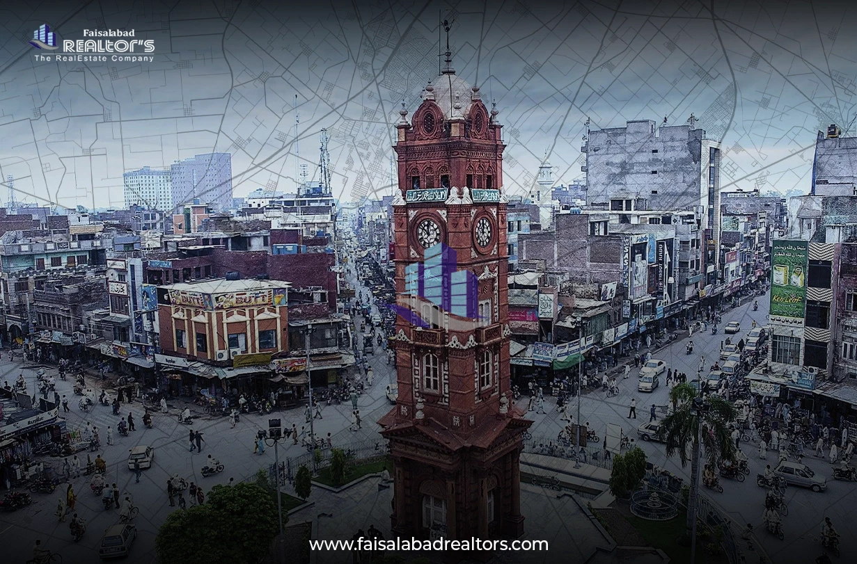
Abdullah Garden Faisalabad Map
As we know Abdullah Garden is a gated community. It is known for its well-maintained infrastructure and peaceful surroundings. A map of Abdullah Garden shows its organized structure with parks, schools, and community centres. It is a perfect and peaceful location for families looking for a secure society for a living experience. For knowing more data about Abdullah garden faisalabad, you must visit their map details.
Eden Valley Faisalabad Map
Eden Valley is another famous residential area in Faisalabad. Its map displays a mix of residential and commercial plots, with parks and recreational spaces. The area’s modern facilities and easy access to Canal Road make it a preferred choice for many. In this way, the Eden valley faisalabad map clears all the questions about any property aspects.
Eden Orchard Faisalabad Map
Eden Orchard, similar to Eden Valley, offers a blend of comfort and convenience. A map of Eden Orchard highlights its residential blocks, playgrounds, and community amenities. The area’s peaceful environment and proximity to main roads add to its appeal.
Iqbal Stadium Faisalabad Map
As we know Iqbal Stadium is one of the most famous cricket stadiums in Pakistan. It is located in the heart of Faisalabad. Its map shows its location near key roads and areas like Jhang Road. The stadium is a place that attracts sports lovers from across the country.
Jhang Road Faisalabad Map
Jhang Road is a major root in Faisalabad which connects the city to Jhang and other close towns. The map of Jhang Road highlights industrial areas, residential societies, and commercial areas along its route. This road is important for trading and daily commutes.
Conclusion
Understanding the maps of Faisalabad and its surrounding areas can greatly increase your ability to navigate the city. From the bustling streets of D Ground to the serene societies of Abdullah Garden and Eden Valley, Faisalabad offers a variety of environments for both residents and visitors. If you are exploring its iconic areas or planning your daily route, these maps serve as valuable tools for discovering the rich number of areas of Faisalabad. So in this article, we discover the importance of maps and their uses for different areas of Faisalabad. Stay updated with Faisalabad Fealtors for any knowledge.
Contact us for:
Office for rent
Office for sale
Agriculture land
House for sale
House for rent
Room for Rent
Flat for Rent
Ideal Farm House
Commercial Avenues
Categories
Recent posts

Which Property Type Gives the Highest ROI?
17 hours ago